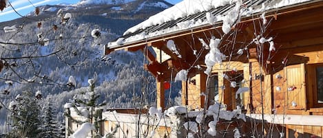
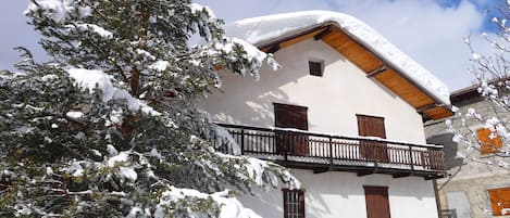
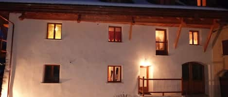
The San Francesco is located in the heart of Bardonecchia, halfway between the main Via Medail and Campo Smith (from where the facilities of the Colomion-Melezet area start). At 300 m. there is the Palazzo delle Feste and the tennis courts. Crossing Viale Roma we find ourselves in the pinewood of Bardonecchia.
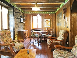
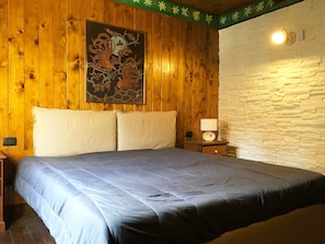
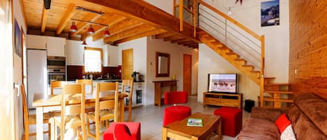
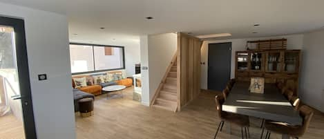
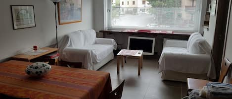
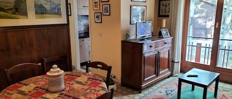
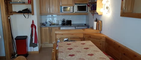
The interior is tastefully furnished, the sofa corner is cheered by the wood-burning fireplace.
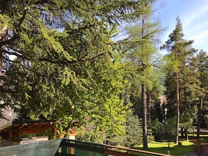
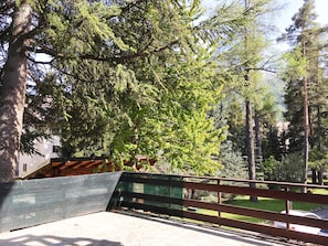
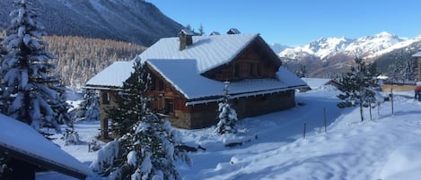
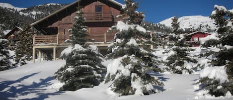
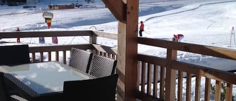
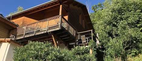
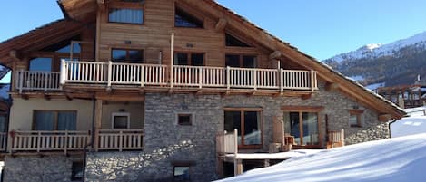
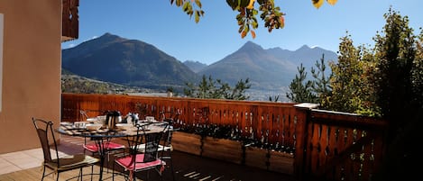
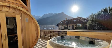
Splendid terrace with its 50 square meters. allows you to live outdoors and sunbathe. Around the villa, you can enjoy the beautiful, tree-lined condominium park of over 3.000 sqm., Ideal for children's games in complete safety.
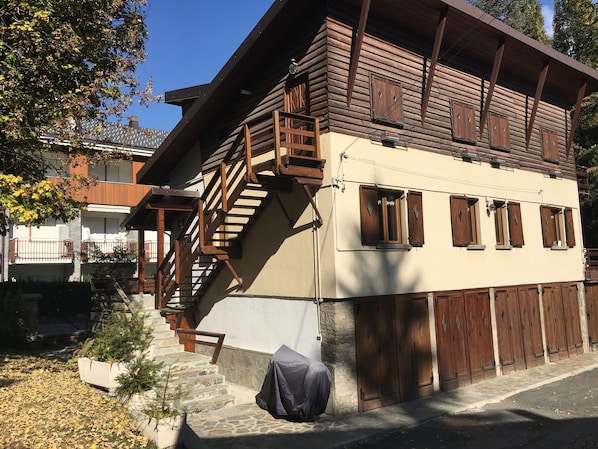
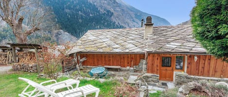
Guests have free access to all areas of the condominium park, parking in the courtyard in addition to the private garage.
The district is the most prestigious residential area in Bardonecchia.
Ideal to move around on foot to enjoy the surrounding area, there are no too steep uphill or downhill sections. So even for the older people it is pleasant to walk around.
(from Wikipedia)
Bardonecia in Piedmontese, Barduneice in Occitan, Bardonnèche in French) is an Italian town of 3 150 inhabitants of the metropolitan city of Turin, in Piedmont, in the upper Val di Susa. It is the westernmost municipality in Italy and in the Piedmont region, an important center for winter sports.
The surrounding valleys and mountains
They are located, clockwise:
the Valle Stretta, (whose upper part falls in the French territory)
the Rho Valley
the Vallone del Frejus
the Vallone di Rochemolles (which also collects the waters coming from Valfredda)
In the middle or upper part of these valleys there are passes that connect the basin of Bardonecchia with France: it is respectively the Colle della Scala, road, and the passes, with only the path, the hills of Rho, Frejus and of Etiache; below the Frejus pass there are two tunnels, one railway and one motorway.
At the basin are many important mountains, many of which exceed three thousand. In particular they have a skiing interest due to the presence of ski lifts, Mount Jafferau and Colomion; from the Alpine point of view are the Valle Stretta Dolomites, the Rognosa di Etiache and the Pierre Menue, the highest peak in the Northern Cozie Alps. Mount Thabor, the Punta Nera, the Punta del Frejus and various other peaks are instead mainly debris and are reached by hiking or ski-mountaineering routes.
The Bardonecchia basin includes an artificial reservoir for hydroelectric use, the Rochemolles Lake, originated from a barrier on the homonymous torrent.
Hydrography
Bardonecchia is crossed by several alpine torrents that, in spite of the name, are practically never dry. It is bordered by the Dora di Bardonecchia, a tributary of the Dora Riparia, which flows just outside the town, practically parallel to the state road 335, called Bardonecchia and the Turin-Paris railway line. In the municipal territory is crossed by two road bridges that connect the state (and the A32 motorway) to the country. They form a sort of fan based at the exit of the village, on the final confluence in the Dora, which goes from the torrent of Rochemolles to the Torrente di Valle Stretta. Proceeding around Bardonecchia counterclockwise, they meet:
the torrent of Rochemolles, whose main branch is born under the tip of the Sommeiller (3333 m asl), which after having formed the artificial basin of Rochemolles (1978 m asl), falls enriching with the waters coming from the side valleys, among which the Valfredda , in the North-Southwest direction and, after collecting the waters of the streams that cross Bardonecchia, it becomes Dora di Bardonecchia:
the torrent of Frejus (also called Rio Merdovine), which enters the inhabited area near Borgo Vecchio (to the north) and crosses the town first in the NS direction then bends towards the east after being crossed by a bridge on the Medail road (in the highest part of the same) and goes down a few tens of meters to the SE of the railway station, joining the stream of Valle Stretta shortly thereafter. It consists of three main branches, each of which is fed in turn by various rivulets:
the Rio Gauthier, which originates under the Punta Nera (3041 m above sea level)
the Rio Chatelard, which originates under the tip of Mount Fréjus (2936 m s.l.m.)
the Rio Pian dell'Acqua, which originates between the Punta Bagnà (3129 m s.l.m.) and the Cima del Vallone (3171 m s.l.m.)
(the latter two join together forming a single stream that flows downstream to the first, in the locality of Grange Merdovine)
the stream Rho, initially formed by two branches, the main one, which originates under the homonymous hill (2650 m s.l.m.), and the Rio Rebour, which originates under the Punta Nera. It delimits the village on the west side, the highest one, exactly as the Dora di Bardonecchia delimits it to the east, in the lower part. It passes behind the Palazzo delle Feste, and then join in the vicinity of Campo Smith to the stream of Valle Stretta. It was the Rho torrent that with its floods of 1872 and 1873 flooded part of the Borgo Vecchio, destroying the chapel of the Holy Sepulcher, located where today stands the Palazzo delle Feste. In 1876 the flooding was repeated but with less dramatic results. [3] [4]
the torrent of Valle Stretta, which originates under the massif of Mount Thabor (3178 m asl, in French territory) and part of whose waters, intercepted by a barrier just before entering Italian territory, feed a small power plant through a branch ENEL hydroelectric power plant. Already in Italian territory, at the beginning of the plain of Pian del Colle it welcomes the waters of the Rio Guilaud which originates under the Passo della Mulattiera. The stream, whose bed is located at the foot of the mountain range Selletta - Monte Colomion, marks the southeastern border of the Melezet and Les Arnauds districts and then join, shortly after Campo Smith, the river Rho and then with this at the Dora di Bardonecchia.